
Esperanto Atlas
Our project draws on the rich treasure of transnational perspectives to open up our field of research. A project that already bears the international level in its name would be nothing if this dimension could not also be represented. Technical opportunities, such as Geographic Information Systems (GIS) or network models, will try to capture the spread of the transnational Esperanto movement.
In terms of sources, the Esperanto movement has generated a great variety of sources from the very beginning and serves us as a veritable treasure trove. Through all kinds of lists of names, we learn about congress participants, club members, or even magazine subscribers. Visualised and differentiated, the maps can help to raise further questions in such cases. Often these are very simple and ask: What stands out? When we look at the maps, questions then arise as to where we can find Esperantists – and just as importantly, where none can be found.
In the near future, there will be contributions here that present various visualisations from our work in the form of an “Esperanto Atlas”.
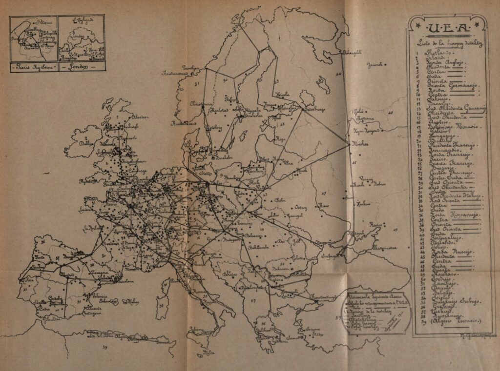
This map from the Universal Esperanto Association (UEA) was published in their official yearbook in 1911 and shows the network of delegates.
Esperanto is… failure? Success? Or “mojosa”? Welcome to Geneva OR Mapping the early congresses
Uncovering Patterns in the Iberian Peninsula — Why did Esperanto succeed?
Bonvenon al Hluk! Bohemian and Moravian hinterland or hotbed of Czech (inter)nationalism?
Who were the Iberian Esperantists of the early 20th century? An overview